Over the past few years, drones have grown in popularity within the forestry/agricultural industry.
Drones have provided impressive new ways to perform work. This is true whether a person is working in surveying, urban planning, or in farming which is using this technology to monitor the status of his crops. This also applies to acquiring data about the environment, and protecting crops from disease and wildlife.
One of the domains in which the use of drones is expanding significantly is the forestry sector, where drones serve as a useful, even revolutionary, tool for the forest industry.
Arborists are determining how the technology fits into their expanding business capacities as they explore the increased efficiencies in reforestation, harvesting and timber appraisals. Researchers have found that using drones in different applications of forestry is not only cost effective but also not very labor intensive.
Here are fifteen examples of how drones can be used in forestry applications:
1. Management Planning
The first step in forestry applications is forest management planning. The reason is that the objectives that a landowner has for his land must be clear and detailed so that actions that should be taken for those objectives can be met. These plans should include information about factors such as acreage, boundaries, forest stands, wood species, and biological inventory. UAV technology significantly increases the quality of the plans and saves considerable time.
2. Document Actions
Drone technology can be of great help when it comes to documenting actions, whether for those who have already been taken or those recommended by the planner for future action. The data from the drone can provide information about the potential need for cleaning or thinning and mapping windfalls after a storm, reducing the costs for recovering the fallen timber so that action can be taken to correct the problems.
3. Detection and Management of Pests and Diseases
UAV technology makes it possible to detect outbreaks of pests and diseases in an early stage, so that corrective actions can be taken immediately. This enables landowners to take preventive actions in order to protect their forests/forestry against future infestations. It is recommended, in such situations, to equip drones with a multispectral camera.
4. Management and Prevention of Forest Fires
Drones can assist firemen in keeping track of fire fronts and identifying the location and intensity of hotspots. They can also help the decision makers direct the firefighting activities. After a fire, drones can quickly find hotspots that might cause the wildfire to rekindle.
5. Management of Large Scale Forest Plantations
UAV technology has become increasingly popular in assessing and managing forest plantations by providing the owner with information concerning crucial factors such as volume, tree height, and the overall condition of the plantation.
6. 3D Mapping for Carbon Storage
In the past, measuring the extent of carbon storage in biomass has been very labor intensive and very expensive, but drones, with their remote sensing, can now be used to get 3D mapping of carbon storage within forests.
7. Restoration of Scorched Land
Wild fires often cause extensive damage to land and soil after the fire has been extinguished, it is the process of land restoration that takes years as it requires extensive land surveying and tree planting. Drones can be used to do these surveys fast and reduce the cost and time of land restoration.
8. Tree Planting
Planting trees in a forested area is difficult because the land is often not evenly distributed and is sometimes inaccessible. Drones can be used to distribute seedlings in these areas in a fast and efficient way and thus make sure trees are planted.
9. Saving Rainforests
Drones are used to do aerial surveys of rainforests to determine where the trees have been affected by human activities and the patterns being used to achieve this. Drones can then relay the data to the relevant authorities who use it to make informed decisions.
10. Monitoring Illegal Quarrying
Drones are used to monitor illegal quarrying, especially in forested areas that cannot be easily accessible by humans. Drones can fly over these areas and take clear shots of the damage that has been caused in these areas and provide the data that the authorities can use in determining what corrective measures to take.
11. Measuring Forest Stockpiles
Most companies are now using drones to measure stockpiles in the forests. Data on the number of logs, and the amount of sawdust and woodchips, can now be easily determined at a much lower cost than before.
12. Dropping Fertilizer
One of the challenging and labor intensive jobs is the sprinkling of manure and fertilizer in forested areas, and drones are assisting in spreading fertilizer over areas that were previously inaccessible.
13. Combating Deforestation
Communities and companies are increasingly using drones to fight deforestation. In addition to using drones to plant trees, these UAVs are now using drones to keep track ot the forests to capture people and their activities that undermine the health, and very existence, of the forests.
14. Forest Research
Unmanned aerial vehicles can easily collect data related to the forests including the extent of the forest cover, forest attributes, etc. Some companies, which are also interested in forest/forestry research, are using drones because they save significant time, and thus money.
15. Forest Security
A considerable amount of forest cover is being lost to unscrupulous business people through logging, which causes global warming. Law enforcement authorities are now using drones to do forest cover monitoring and arresting the people who are guilty of such destruction.
Drones with Incredible Sensors
Drone software makes it possible to capture real time video and autonomous aerial photos by enabling the drone to fly at a given elevation and capture overlapping images autonomously. Image processing software stitches all these images into a single photo, which is then imported into the mapping software for analysis.
Drones with sensors that are multi-spectral, hyper-spectral, thermal, infrared can also:
- Ensure rigging and equipment are secure, procedures are being followed
- Count trees
- Map harvest units
- Complete inspections in all phases of harvest operations
- Measure rock stockpile volumes
- Assess different types of damage (e.g. bear, insects, fire, root rot, etc.)
- Detection of power lines in dense areas where the lines and trees are close together
- View a 3-D image of the area
- Identify different species of trees
- Search for rock sources
- Identify sick or stressed trees
- Locate hotspots from fires
- Fly seedlings out to the planting crew
- Spray maple clumps
Certification
Due to recent changes by the Federal Aviation Administration, it’s now less expensive to obtain drone operator certification. In addition, the cost of drones continues to decline even with advances in drone technology.
Applications
It is possible to capture real time video and autonomous aerial photos.
The drone software enables the drone to fly at a given elevation and captures overlapping images autonomously. Image processing software stitches all these images into a single photo, which is imported into the mapping software for analysis.
Guidelines
Because of the increasing popularity of recreational drones, the U.S. Forest Service has released specific guidelines for recreational unmanned aircraft use over public lands:
- Avoid flying over federally-designated wilderness or primitive areas.
- As drones are considered both “motorized equipment” and “mechanical transport,” they cannot take off from, land in, or be operated from, federally-designated wilderness areas.
- Avoid flying over noise-sensitive areas or populated sites, including rivers, campgrounds, trail heads and visitor centers.
- A drone may not be used to disturb or harass wildlife.
- No interference with official aerial activities over national forests, such as wildfire detection and suppression.
- Drone pilots must obey state privacy laws.These guidelines only apply to hobby or recreation operations. Commercial operations include filming, still photography, surveying, or any other endeavor for profit that involves use of a drone. These ventures may be allowable through a special use permit issued by the Forest Service. US Forest Service Clarifies Drone Use. Posted by Thomas J. Coyle III (February 14, 2016).
Different Types of Drones
There are two types of drones: fixed-wing and rotor-wing. Fixed-wing drones basically look like model airplanes that can fly over larger distances, making them a better choice for larger points of interest, since it is possible to fly over hundreds of acres in one flight. Arborists (tree care professionals) might use fixed-wing drones to acquire inventory of trees, to create imaging and mapping, and to conduct environmental assessments.
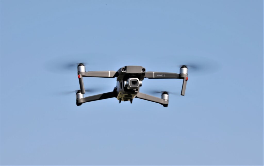
The other type is rotor-wing drones, which is probably what people think of when they hear the word “drone.” Rotary is great for hovering and seeing something very close up. They’re also better for smaller, more enclosed places. Rotor-wing technology can also benefit a tree care business through plant health monitoring and inspection.
Opportunities Using drones in forestry applications undoubtedly implies a number of advantages, such as time and cost savings as well as increased operational efficiency. Although the use of drones in forestry may still be in an early stage, the technology definitely has great potential in the near future.


